
Washington County Streets: Start by Address
Address research in Washington County starts with the street location, not a presumed resident name. Use the physical or situs address to locate the parcel, then preserve the parcel ID and legal description before comparing other records. The county assessor and GIS viewer help establish the parcel tied to a street segment. A recorded deed can establish a documented ownership transfer, while a directory or a voter record answers a different and narrower question about a person. That order keeps a street directory search from turning a tax mailing address into an unsupported claim about everyone at a property.
- Enter the house number and street name in the assessor search. The county instructs searchers to omit the city and ZIP from that form.
- Save the parcel ID, situs address, mailing address, and legal description shown in the parcel detail or tax record.
- Open the same parcel in county GIS, then pan along the street and click nearby parcels only when they matter to the question.
- Use the legal description or current grantee in RecordEASE to find a recorded deed, instrument number, and earlier transfer trail.
- For one registration-status question, use the state voter tool. A street-sorted Walking List has separate eligibility and use limits.
- For an earlier household, compare the street in a dated Stillwater directory, newspaper, census, or map rather than treating a present parcel result as history.
The useful chain is address to parcel, parcel to legal description, and legal description to the correct custodian. That record trail can show where to look, but each link has a different date and scope. A tax notice may name a taxpayer. A deed names recorded parties. A historical directory can place a listed person at an address in its publication year. None of those records alone supplies a complete household roster.
Note: Preserve directional terms, unit numbers, and the county’s displayed address before trying a shortened or historical version.
Washington County Assessor Street Fields
The basic assessor form is the fastest Washington County street directory starting point when the house number and street are known. It is deliberately address-led. The form has no owner-name field, so an owner-led search belongs in the GIS route instead. The assessor also distinguishes a physical address from the mailing address used for tax correspondence. That difference matters in a street search because a mailing destination may be outside the parcel and does not prove someone lives there.
The Washington County Assessor Property Search is shown below.
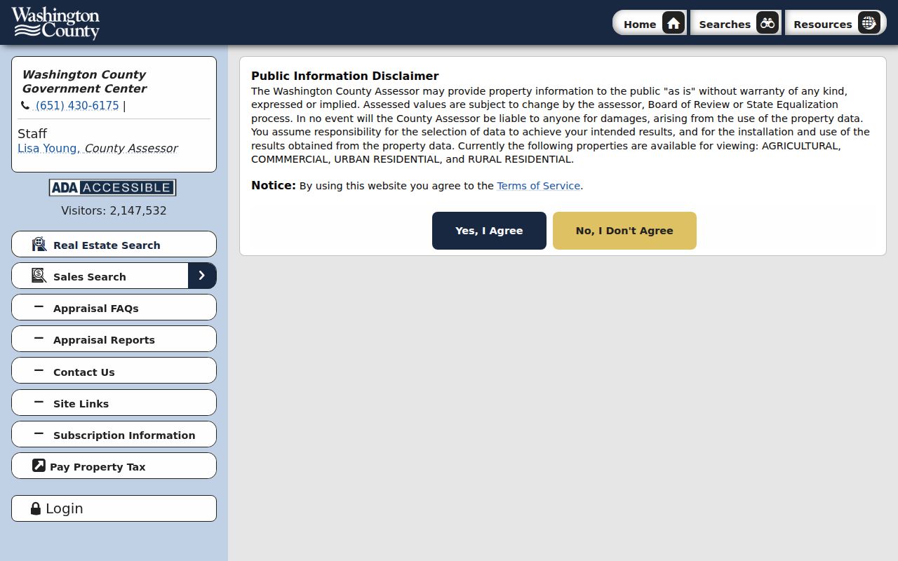
The form illustrates the county’s address-first workflow, including the separate property-class and parcel-display controls.
Use the narrowest available field. A partial parcel number can use the percent wildcard, while block and lot or section, township, and range can help with rural land or an address that no longer matches a current street format. The property-class choices are Agricultural, Commercial, Urban Residential, and Rural Residential. Acreage controls run from zero to 821 acres. Search results may supply a parcel number, tax description, class, value, and tax-related fields, but not every parcel type displays every field.
| Assessor field | How it helps a street search |
|---|---|
| Physical Address | Enter house number and street name only, without city or ZIP. |
| Parcel Number / PIN | Supports % wildcard searching when the full number is unknown. |
| DBA | Searches a business or trade name, not an owner-name field. |
| Block and Lot | Connects a subdivision description to a mapped parcel. |
| Section, Township, Range | Helps locate rural or older legal-location descriptions. |
| Property Class | Narrows the result set by the four listed county categories. |
| Parcel Display | Lets a searcher choose all parcels or parcels with photos only. |
Washington County GIS Along Each Street
County GIS adds the map context that a text form cannot. Washington County says its GIS draws from Assessor, Land Records, Recorder, and Surveyor sources. Search by address or parcel ID, then use the parcel, address-point, road, and district layers to understand which mapped feature belongs to the street location. The county’s separate map implementation also exposes owner searching, an important contrast with the basic assessor form.
The Washington County GIS parcel viewer is shown below.
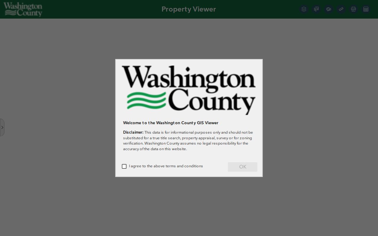
The viewer is best used to confirm a parcel’s position and open its supporting details, not to treat a colored polygon as a complete ownership record.
For a Washington County address-map question, click the target parcel first and record its ID before moving along the block. A road centerline, a common area, or a condominium feature can make a visual neighbor seem more certain than it is. Use the parcel link for tax and assessment details, the Recorder for a document, and a survey or plat for a legal boundary. The Surveyor also offers a prepared surrounding-property-owner list by request when a formal product is needed.
| GIS control | Washington County street use |
|---|---|
| Property ID search | Find a known county parcel or PIN. |
| Address search | Locate a house and street on the map. |
| Owner search | Start a name-led property check, unlike the basic assessor form. |
| Details panel | Open parcel information and linked records. |
| Layer toggles | Compare tax parcels, address points, roads, and county source layers. |
| Map browse and click | Inspect a target parcel and nearby mapped features. |
| Export control | Visible in the county map implementation; use only within county responsible-use limits. |
Washington County Address Records
Several address labels can appear in the same Washington County property trail. The situs address is the physical parcel location. A tax mailing address is where the notice goes. The legal description identifies land through a lot and block, subdivision, metes and bounds, or public-land-survey terms. A postal city and ZIP describe delivery, not necessarily the taxing jurisdiction. Keeping these labels separate avoids a common address-record error: assuming a taxpayer or postal label identifies a current occupant.
- Parcel
- A specific tract recorded in county assessment and land records, commonly tied to a county parcel ID.
- Situs address
- The physical location assigned to the parcel, distinct from a tax mailing address.
- Plat
- A recorded map that lays out a subdivision, lots, blocks, streets, or easements.
- Criss-cross directory
- A reverse-style directory used to move from an address to a listed name for a particular historical year.
Washington County’s original land survey dates to 1847, and newer parcel IDs still sit on that older survey and subdivision framework. When an old directory uses an intersection or former number, the legal description, a recorded plat, or section-township-range is often a better bridge than a postal label. The County Surveyor’s records include detailed PLSS and survey material, while actual surveys can be viewed at the Public Works counter. Only surveys before March 1, 1989 are listed as photocopiable.
Note: A homestead classification is an exemption or classification clue, not conclusive proof of who occupies a parcel.
Washington County Street Record Coverage
A Washington County street directory search uses records that were made for separate government functions. The table below keeps their limits visible. Property and tax records are strongest for a parcel and taxpayer or owner context. GIS is strongest for location and adjoining shapes. The deed index records instruments and parties. City permit systems date project activity. Historical directories and newspapers can place a name at an address in a past year, but they have coverage gaps and publisher omissions.
| Address record | Washington County custodian | Useful street evidence | Access route |
|---|---|---|---|
| Assessor and tax roll | Assessor / Taxpayer Services | Parcel, taxpayer or owner, situs, mailing, class, value, and tax year | Assessor search, GIS, tax records, or public request |
| GIS parcel and address layers | County GIS and linked land offices | Parcel boundary, address point, road, parcel ID, and detail links | Public ArcGIS viewer, pan, click, and search |
| Recorded instruments | Recorder / Property Records | Grantor, grantee, date, instrument, legal description, liens, plats | RecordEASE from 1984, then research room or archive |
| Survey and subdivision records | County Surveyor / Archives | Lots, blocks, corners, plats, certificates, and coordinates | GIS or survey viewer, Public Works counter, and copy rules |
| Building permits | City of record | Project, applicant or owner, contractor, permit, and inspection dates when public | Cottage Grove and Woodbury online routes; Stillwater or city request |
| Voter list | Minnesota elections system | Permitted voter fields in a qualified Walking List, sorted by street and house number | Restricted statutory request, not an open street roster |
| Historic directories | SPL, MDL, and local history sources | Listed resident, street address, occupation, and year-specific household clues | Digitized or in-library collections with known gaps |
Use the county’s Recorder / Property Records route for current office rules and the Public Research Room for pre-1984 deed work. A missing online result can mean the document predates the portal, uses a different legal description, or needs a counter or archive search. It does not establish that a property had no prior owner or resident.
Washington County Deeds by Street
RecordEASE is the Washington County address-record source for recorded property transfers and related instruments, not a resident list. The online abstract and Torrens index reaches from 1984 to the present. Search the current owner as grantee or use the legal description and a narrow date range. On the purchase deed, note the seller as grantor, recording date, document number or book and page, and any linked certificate or prior reference. Then search that seller as grantee in an earlier period to work backward.
The Washington County RecordEASE deed index is shown below.
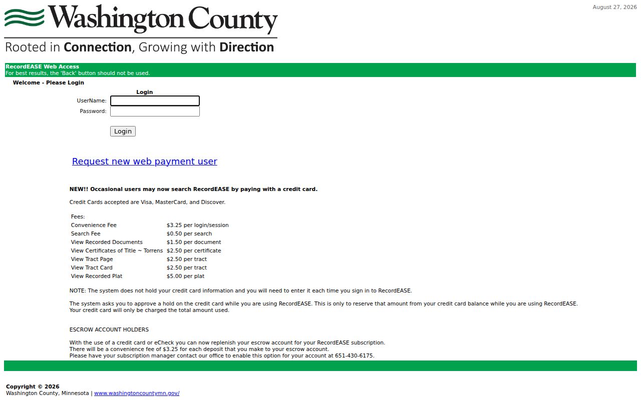
The portal presents the recorded-document trail that can verify a transfer once the correct parcel or legal description is known.
For older Washington County deeds, shift to the Public Research Room, Recorder materials, archives, state resources, or collection items available through FamilySearch. A street number may change while the legal description persists. RecordEASE lists a $0.50 search charge, $1.50 document charge, and other account, certificate, and copy charges, so confirm the live county fee table before ordering. The county also warns against multiple-parcel downloading, screen scraping, and data extraction. Targeted research protects both accuracy and the county’s stated use limits.
- Party name and role, such as grantor or grantee.
- Document type and recording date.
- Document number or book and page, with tract or certificate context where available.
- Legal description, including a lot, block, subdivision, metes-and-bounds, or tract reference.
- Related instruments, tax-lien or plat context, and linked certificates where exposed.
- Image or copy access, subject to county charges, redactions, and protected-record rules.
Washington County Street Address Changes
A Washington County street search has to account for address history. Early Stillwater directories can use an intersection rather than a house number, and local guidance warns that late nineteenth-century house numbers changed. A later postal form can also hide a township or municipal distinction that mattered when the record was created. Compare the exact directory spelling, directional term, street type, and local geography before deciding an address is a match.
For a difficult Washington County address, use the GIS address points and road centerlines to check the modern form, then test the old form against a plat, legal description, historic permit, Sanborn map, or city street and ward information. The agreement map does not create a list of every renumbered house. Its value is more modest and more useful: it signals when a city or township may have followed a different addressing history.
Washington County Permits by Address
Permits add a dated activity layer to Washington County address research. Stillwater historic permits begin in 1886. Cottage Grove lists current permit categories, and Woodbury has an online building-permit and inspection route. When public, a permit record can identify a project, applicant or owner, contractor, permit number, issue or final date, and inspection event. It can show when construction or alteration was documented, but it does not prove a title transfer or every person who lived at the address.
If the address search fails, Cottage Grove’s permit guidance says a searcher may omit the street type, unit, and directional from an exact address search. That is a useful normalization test after preserving the original address separately. For a missing municipal file, identify the city of record and ask for the specific permit, code, or inspection record under Minn. Stat. §13.03. Washington County includes cities, townships, and partial municipalities, so a county postal label alone is not enough to choose the permit custodian.
Note: Compare permit dates with deeds and tax records because construction activity and ownership transfers are different events.
Voter Records Along Washington County Streets
Voter information has stricter limits than parcel research. The state status form checks one person’s registration status and should not be described as a bulk resident roster. A match may confirm status and election jurisdiction, but the research did not capture every live result field. A non-match can reflect a name or date mismatch, a recent update, a protected record, or no active registration. Contact Washington County Elections or use the state registration route instead of drawing conclusions from one failed form.
The Minnesota voter-status lookup is shown below.
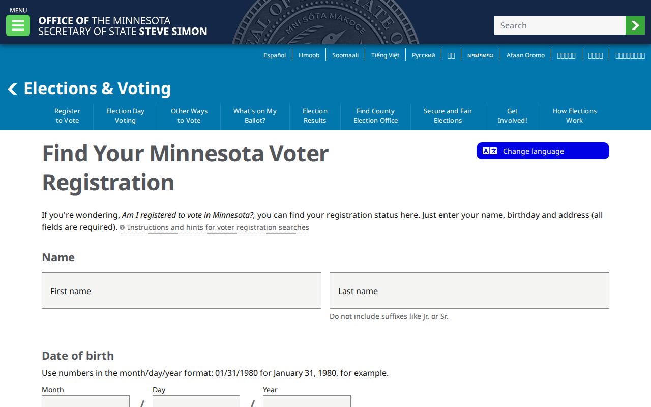
The interactive form is for a status question, while the statutory report request is the separate route for an eligible voter list.
Under Minn. Stat. §201.091, a Walking List is sorted by street and house number and may include permitted fields such as name, address, year of birth, phone if provided, and a six-year voting-history summary. Only registered Minnesota voters may obtain the list, and its use and publication are restricted. The area report costs $30 and a statewide report costs $46 under the research reviewed. Safe at Home and protected-voter procedures can withhold a real address by design.
Old Street Addresses in Directories
Historical directory evidence answers a past-address question more directly than a modern parcel screen. Stillwater runs begin with the listed 1876–77 volumes and continue unevenly through Washington County directories listed through 2023. An entry can supply a name, address, and occupation, but a directory can omit women, children, boarders, rural residents, or anyone the publisher did not collect. Record the exact volume year, page, spelling, address form, and geographic scope before comparing an entry with a deed or census.
The 1887 Minnesota Digital Library scan and later digitized, library, and subscription-access runs make address-to-name research possible in selected years. A directory’s front matter can explain abbreviations and street coverage. For the full collection history and a reading method, use the Washington County City Directory route. When a household disappears, try adjacent volumes, local newspapers, obituary indexes, probate, or a census rather than treating a gap as proof of a move.
Washington County Street Search Limits
Even a well-researched Washington County street directory cannot identify every person at an address. Public parcel records do not reliably identify renters, guests, household members, utility customers, delivery recipients, or protected voters. Minnesota motor-vehicle personal information is restricted by the Driver’s Privacy Protection Act. Court files, vital records, and election records also carry their own confidentiality rules. The absence of a name from an online record may be intentional, delayed, or simply outside that record’s purpose.
Keep the question narrow. “Who owns this parcel?” belongs with the assessor and Recorder. “What work occurred here?” belongs with the city permit file. “Who was listed here in 1908?” belongs with the dated directory and its companion sources. The record’s own date, fields, and restrictions are part of the answer, not fine print to ignore.
Note: Protected records and Safe at Home addresses create deliberate gaps that should never be worked around or republished.
Washington County Records, Online and Counter
Washington County has a useful two-speed street research system. Current parcel mapping and post-1984 recorded documents are convenient online. Older deeds, historic permits, survey context, maps, and many directory materials need a counter, microfilm, archive, or library visit. That difference is not a failed street directory search. It is a sign to change custody and preserve the parcel or legal-description trail while doing so.
- Assessor and GIS
- Use online parcel mapping first, then turn to Assessor, Surveyor, or Public Works records when a legal or survey question remains.
- RecordEASE and the research room
- Use the online index from 1984 forward, then the Public Research Room, Recorder, archive, or historical collection for earlier title work.
- Permit portals and city records
- Use an online city route where offered, then ask the city custodian for historic or missing permit and inspection records.
- Digitized and in-library history
- Use scans to find a year or name, then consult Stillwater Public Library or local-history material for page images and collection gaps.
The comparison is especially important in older Stillwater and rural Washington County research. A current PIN can lead back through a plat or survey to an earlier land description, while an old address may need a map or directory before it can be joined to the parcel. Use the office that holds the record rather than forcing every question into a single online search.